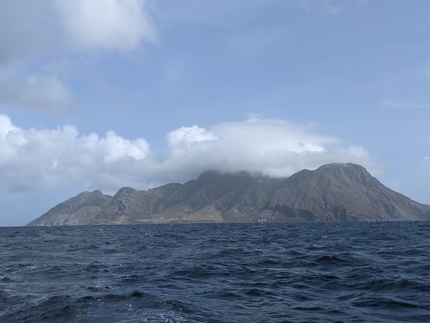
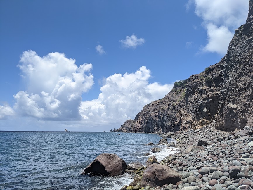
Our first morning in Saba we woke up to the intimidating cliffs beside the boat.
We went ashore at the purple beach, wary of any rockfall from the crumbling cliffs that towered high above our heads. Hopefully nothing lands on the dinghy! We walked down the beach until we found a road in the purple dirt that took us into Fort Bay.
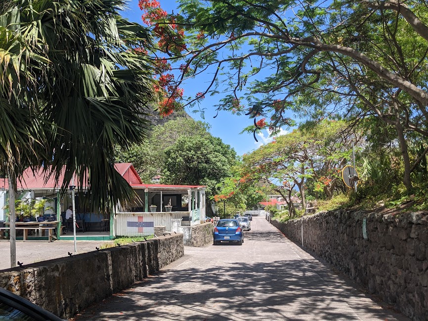
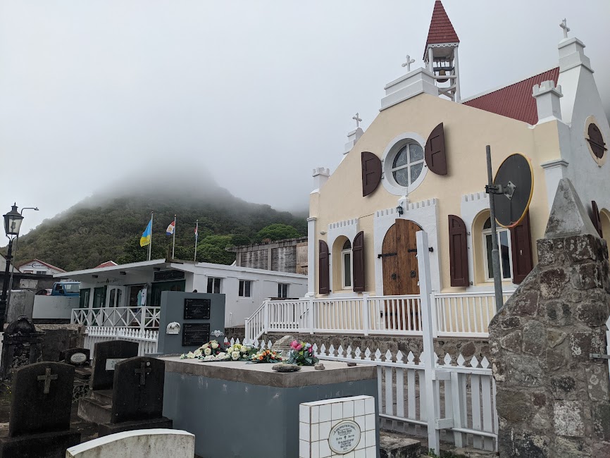
The tiny town was interesting, it was one road beneath the towering hills and cliffs, next to a wharf within a small breakwater. It was a small enough town that you could walk across it in 5 minutes. The wraparound breakwater made a tiny calm harbor with some fishing boats pulling up inside it, and outside were the rugged waves of the open sea. The seafaring people who live here must be very intense, because this place is just a massive rock, located in a notoriously hardcore part of the ocean.
Fort Bay was an industrial setting, with one restaurant where the fisherman characters hang out, and it had the customs and national park office. To check into customs we had to go through a lot of rigamarole, pass though 3 different offices, and let one woman call her supervisor because we were without one apparently important piece of paperwork (the ‘check out’ form from the Virgin Islands… which we had no clue we needed…). She issued us a warning and our passports were stamped from Saba, Netherlands.
What a grand waste of time! That’s okay, at least now we knew what national park rules we were breaking, and we’d have to move the boat to an approved spot. So, first off, we went to go explore the island! We started walking up the road to the main town called “The Bottom.” It was funny, as the road began climbing upwards insanely, “The Bottom” is way the hell up there! But almost immediately as we started climbing, someone stopped and offered us a ride in the back of their pickup truck!
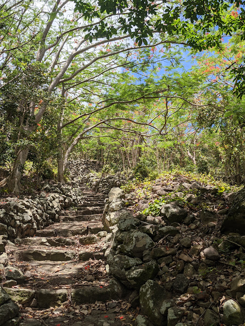
It was among the top 5 most fantastic hitchhikes of my life, maybe competing for the top #1! The road switchbacked and climbed around hairpin corners, though a massive canyon that was lined with bright red flowering flamboyant trees. All the colors were so bright, the steep dirt with a purple or golden hue, covered with shocking green grass or lush vegetation between the rocks. Then we made it up and up to The Bottom.
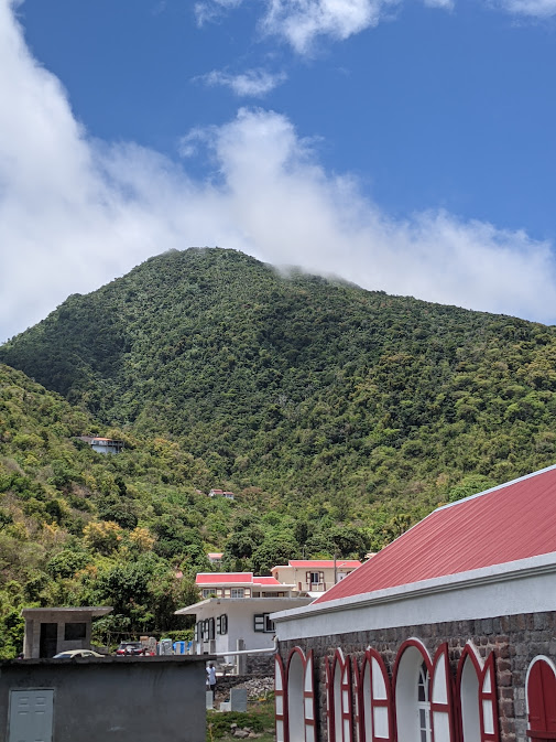
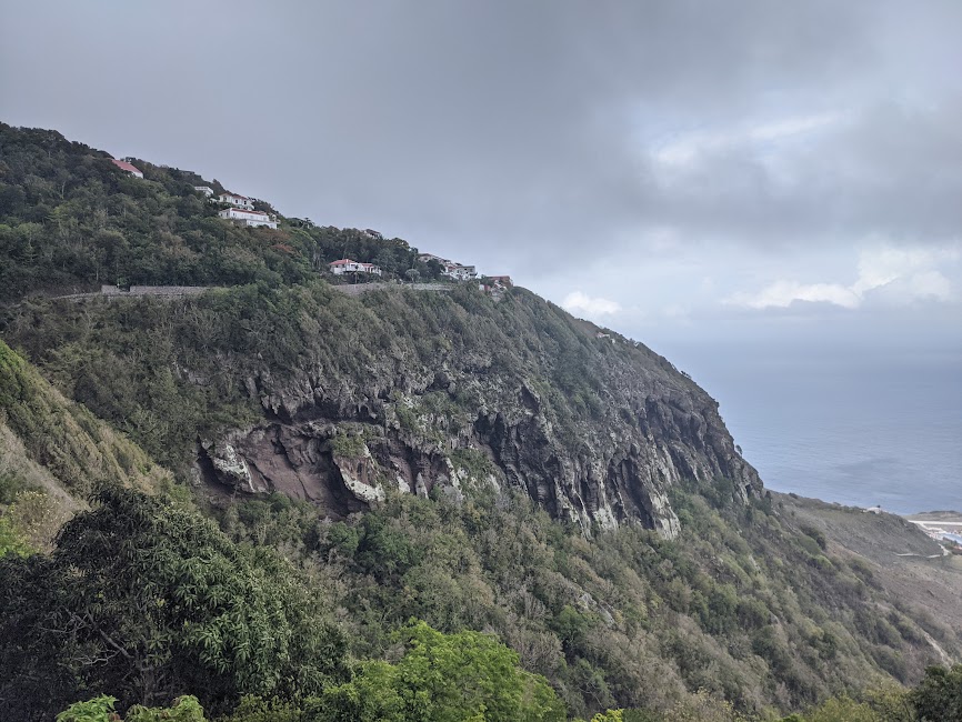
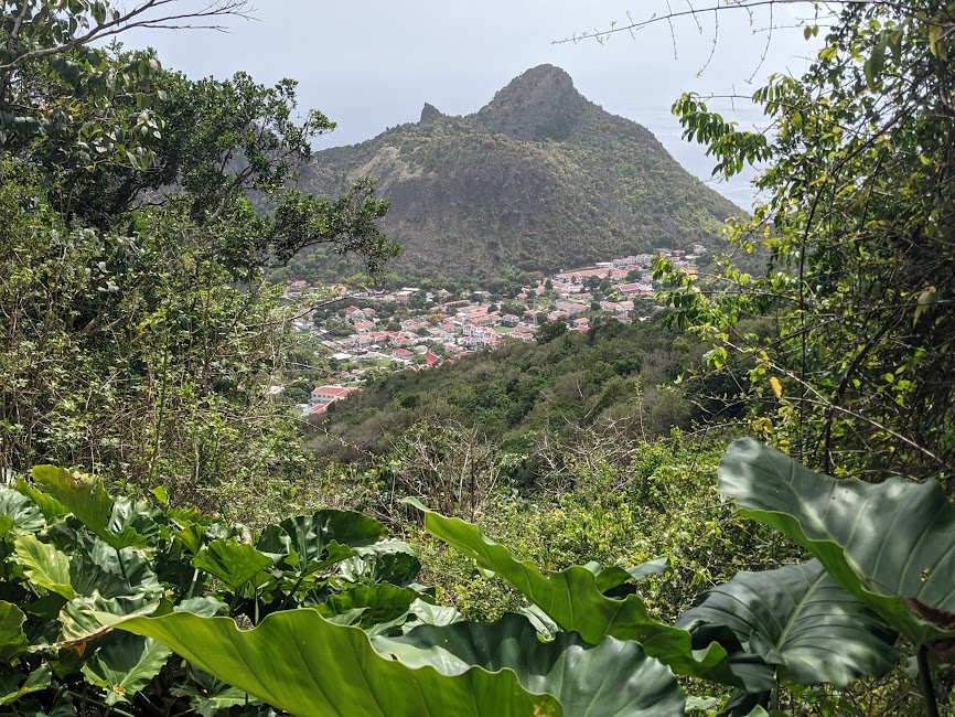
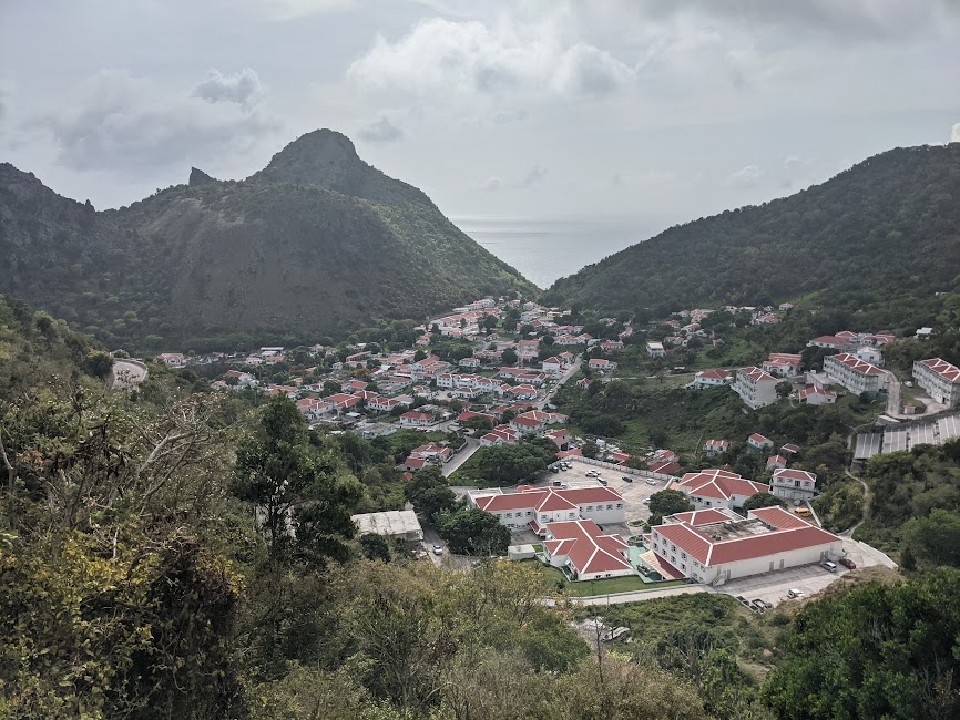
Our driver asked us if we wanted to get off and we decided to keep riding to wherever he was going! There was another town on the island called Windward Side, lets go! The Bottom was built in a flat area, surrounded by dramatic hills on all sides, and it was at the base of the tallest peak on the island, Mt. Scenery.
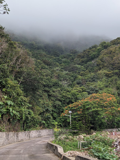
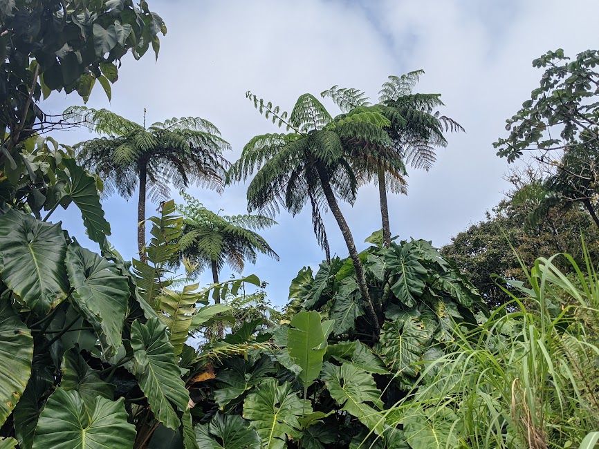
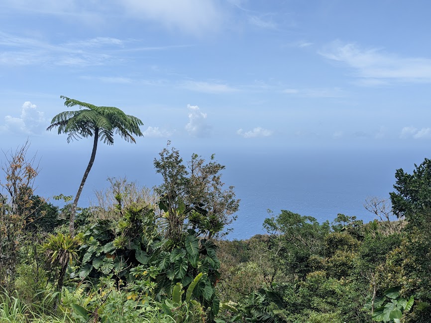
Immediately as we left the town, the road was switchbacking up the shoulder of the volcano, and it was densely forested with emerald green foliage all the way to the summit. Fort Bay was down in the sun scorched desert, but this peak was covered with verdant rainforest. They even call the top a “cloud forest” and there was a cap of clouds hovering over the mountain.
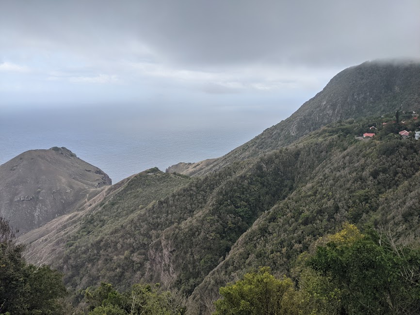
The road climbed and crested a ridge. Before us was the marvelous ribbon of road cut into the rock, traversing the side of the epic peak, high above the blue ocean.
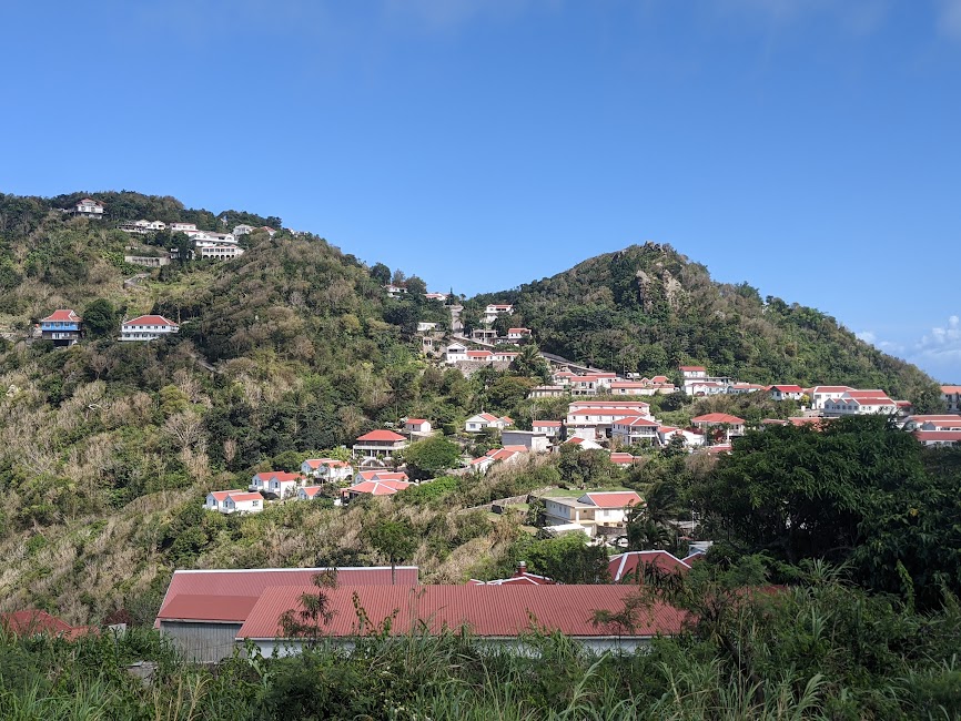
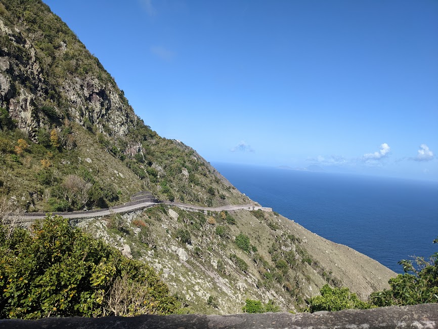
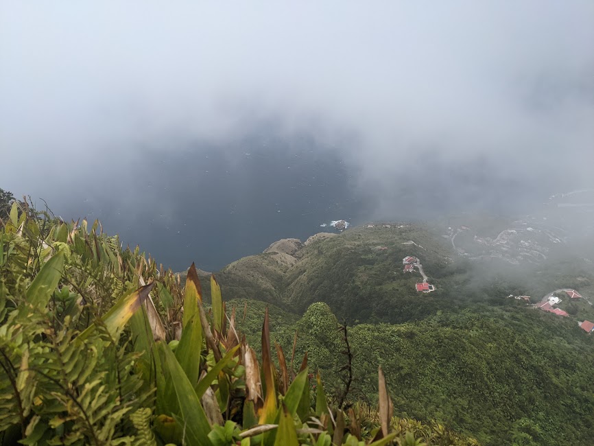
When we got to the end of this amazing stretch of shoulder-less, narrow concrete highway, we arrived in the village of Windward Side. The streets of the village were narrow, with cars stopping to let one another pass, and dozens of people walking through all saying good morning to eachother. The slopes of the mountain rose right out of town and a cloud was blowing across. Mist obscured the summit, and the gentle mist wafted in the refreshing breeze down the village streets. The air was cool! Not destructively hot like we are used to in the Caribbean, it was absolutely glorious up there!
We sat down to eat at a little European bakery, with fresh, homemade bread, and amazing lattes. The sandwich we got was so good I almost broke down in tears!! I was overwhelmed with joy to be in this wonderful place. People were smoking at the outside seating, I haven’t seen that in years. It felt like we were in a quaint village in the French countryside, although this place is Dutch, but it had a European charm that I’m not familiar with at all. I loved it!!!
We made some phone calls and sat under the umbrella that sheltered our table from the light rain. Then after becoming extremely satisfied with the coffee and food, we took a walk! We walked out of the misty village, and down a long road that was cut into the mountain. The views were excellent under the cool cloud cover, and we wandered around for a long time, to the next little neighborhood called Zions Hill.
After that we hitchhiked with ease all the way back to Fort Bay. We weren’t even sticking out our thumbs, a guy just pulled up and offered us a ride. In the back of a truck of course, so fun!
.
.
The next day we moved the boat around to the approved mooring ball area. We had a lot to do, the boat’s steering was acting funny, so we had to pull everything out from under the cockpit seats and check out the steering cable. We saw the problem, and tightened her up. Fixed it without too much trouble.
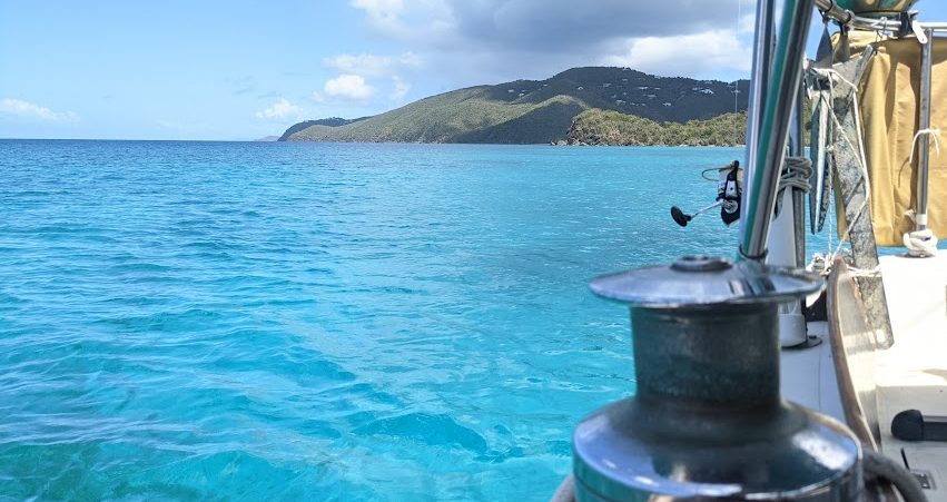
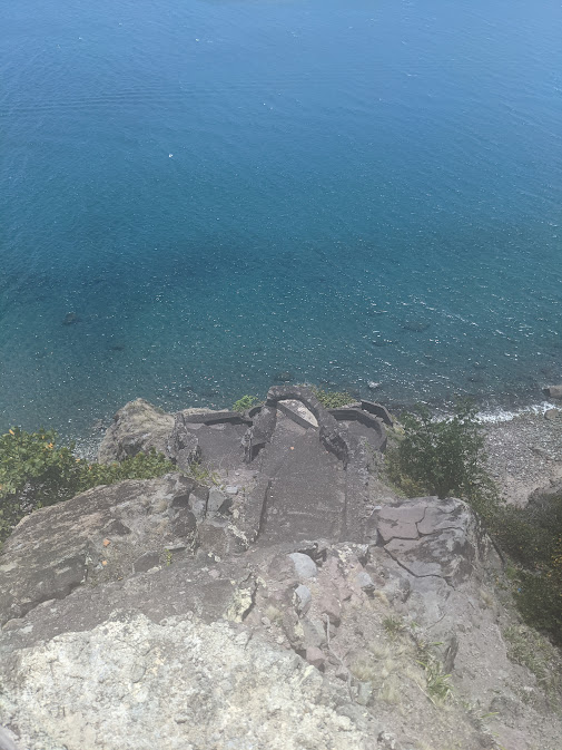
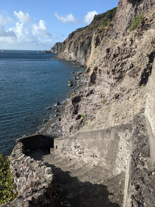
This mooring ball was in a place called Ladder Bay, just a few miles down the cliffs from where we had originally stopped. And the view was even better here, we could see all of Saba’s west side from this place, the entire band of cliffs and Mt. Scenery above it. However, the wind was really extreme here, and the waves were not at all calm either. And we were pretty far from shore.
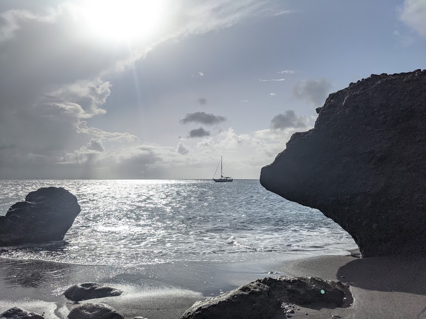
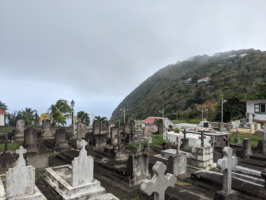
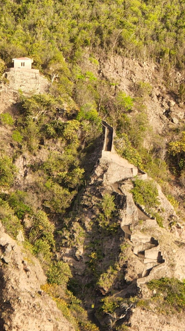
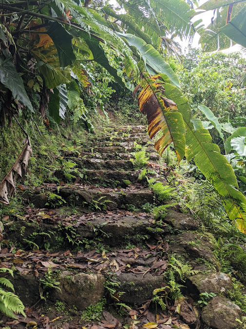
They call it Ladder Bay because it’s got a ladder built into the cliffs from the days of old! It’s actually an old stone and concrete staircase, and it was the original way people came to shore on Saba. Back in the 1700s Saba was colonized by pirates, banished from England and Jamaica, who must have been very intense people to crash land their boats onto this boulder strewn shore. They built the winding staircase, nearly vertical, up the cliffs so that they could haul their goods back and forth to the Bottom. Amazing to think about those people and their lives here.
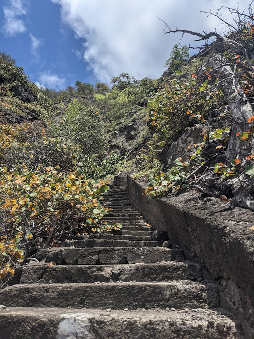
We were told not to climb the Ladder by the National Park Service. It wasn’t technically off limits, just highly discouraged, because of the danger of landing the dinghy on the beach at it’s base. But how else was I supposed to get to town? I don’t have a fast, expensive dinghy, so we actually can’t make it back to Fort Bay any more… It’s too far from here. So, it seems the ladder is my only option! And since we’ve decided not to stop in the next island of Statia, or even go ashore at the following islands of St Kitts, Nevis, and Montserrat, it looks like I have to climb up that ladder to stock up on some groceries and water, and haul my goods back down the ladder just like in the pirate days of old!
So I left Dad, he was going to do some snorkeling in this majestic place, and I went off on my journey up the ladder. It was so cool and absolutely beautiful to climb the hundreds of stairs up the wicked cliffs.
I had a crazy day. I was visiting the customs house again, they said we could “check out early”… This way, on the day of our sail, I wouldn’t have to come to customs first thing in the morning. So I walked on down from the Bottom to Fort Bay, and at the customs house they told me that the officer I needed wouldn’t be there until 5 or 6pm… ok, well, Dad had dropped me off at the ladder, and I told him I’d be back before sunset. It was 1PM. I didn’t exactly know how I’d make today work out…
Immediately after walking out of the customs house, I was offered a ride by friendly people, and whisked away back up to Windward Side! Well it was lovely to be there again! I made friends with so many people! Everyone you meet on the street in Saba you wind up stopping and talking to for 20 minutes! I kid you not, this place is just magical like that. In fact, time passes very fast in Saba, you realize each day disappears, and it’s because of all the combined hours you spend talking to people!!
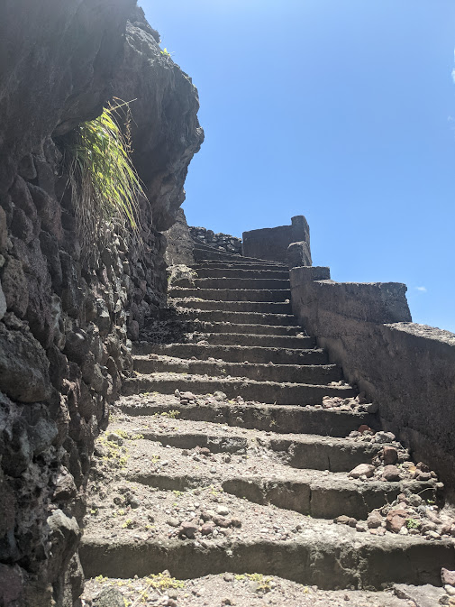
So before I knew it I had a bag full of groceries, water, and ice, it was 5PM, and I was chatting with a great guy in The Bottom and drinking a rejuvenating ginger lemon juice. I actually went back down the ladder, and blasted my airhorn 3 times to call Dad. He was having a very nice day, but was shocked when I told him I had to go back up the ladder! I left the groceries with him, and climbed up that thing in record time! Then making extremely good time, unable to catch a ride, I hiked back down to the customs house. They stamped the passports, and gave me my important document. Then into the fading light of evening I started back up the road to the Bottom.
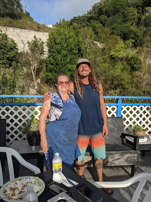
I was picked up hitchhiking by an old Dutch woman, actually she was Saban, born on the island and never left. Her name was Lollipop! What a character, and she had a restaurant/ guest house on the island. She gave me detailed instructions of a good loop hike of Mt. Scenery, and I told her that Dad and I would come stop in her restaurant after we had done the hike tomorrow! Only when I got out of her van and she was driving away, did I realize it said ‘Lollipop Taxi’ on it. So… I was picked up hitchhiking free of charge by a taxi cab… Wow, where else but Saba will that happen!
…
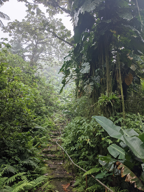
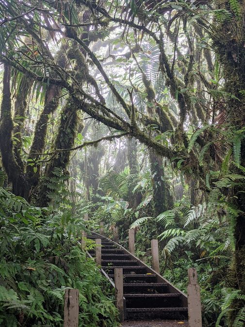
The following day, Dad and I climbed up the ladder first thing in the morning. We got coffee, then caught a ride to Windward Side. From there we began the Mt. Scenery hike!! And before long we made it to the top, there was an incredible staircase the entire way up. It was a fantastic day.
Afterwards we had dinner with Ms. Lollipop at her bed and breakfast, on her porch overlooking the cliffs and the sea. I had a Dutch specialty called Kapsalon, which is like Canadian’s poutine, its a bed of French fries covered with meat, cheese and sauces, but the Dutch throw a salad ontop. It was an unforgettable meal!
That night we prepared to leave Saba the following morning. The weather was acting crazy though, the volcano seems to make wraparound winds hit us in extreme gusts in that spot. The weather out at sea should be normal… But at Ladder Bay I couldn’t ever get a proper night of sleep, the wind would calm for a while and then slam the boat with an extreme wind gust, so jarring that it wakes me up over and over in the night!
That night I felt the strongest wind gust I’ve ever felt on Mary Jo! It was probably 60mph… I stood up immediately with a surge of adrenaline as it seemed like it could part our mooring line! It flipped the dinghy upside-down! And it did a bunch of other whacky stuff too, it blew Dad’s shorts off the line and away to the ocean, that was a shame. It also blew my grill open, I’ve never seen that happen.
…
First thing in morning we got underway! It was a little daunting, because the wind was still strong and gusty! But the weather forecast told me it would even out at sea. It did say the wind at sea was stronger around Saba. It seems that Saba is always an intense spot. We gotta get out of here! The island may have been the most beautiful island I’ve ever seen, but it is a challenging place for a boat!
We hoisted the mainsail and motored out around Fort Bay. The wind was extreme, blasting us with huge confused waves. It felt angry, and squall clouds were in the sky. They had never left, not since the Anegada Passage, we’ve still had continuous squalls each day. But we gotta keep moving… Even though I don’t like sailing when conditions are extreme.
I assumed they would get better as we went out to sea. They didn’t really… We kept motoring and the wind did get more steady and less gusty once we were clear of Saba. Then we went to put up the jib sail… But we hesitated. The wind was very strong. We knew the sailing would be too intense. Eventually it lulled slightly, and we sent up the sail and turned off the engine. Now we were flying.
Destination was St. Kitts, we couldn’t see it in the distance. Through the haze we could see the next closest island to us, St. Eustatius, also called “Statia.” We headed for the large volcano called “The Quill” that we could see rising from the coast of Statia. Saba spread out grandly behind us as we left, looking absolutely awesome with it’s smooth hat of lenticular clouds. Saba is extreme.
It wasn’t long before I heard a dreadful twang sound… I didn’t notice it until about 10 seconds later, that yes, I had heard some sort of twang. Then I realized it was the lower shroud on the port side. The shrouds are cables that support the mast. You need them… if they break, the mast falls down, and that’s a catastrophe of epic proportions.
The shroud was slowly and slightly unraveling, it being a cable of many braided strands, and one of the strands had snapped with a twang. I then noticed another shroud had a kink in it. Oh no!
What do we do… Dad what should we do? It was now only a matter of time before the rest of the shroud would part, if we kept sailing so hard. I knew these shrouds were very old. I had known that for a long time, that the boat actually needed new rigging. Its a difficult and expensive process to re-rig the boat, usually involving pulling out the mast with a crane at a marina and replacing the cables on land.
But what should we do about this? Should we keep going? Should we stop at Statia instead of St. Kitts? We can’t turn back for Saba, Saba really can’t help us with this one and is not a calm place to be! We then realized, we gotta go to St. Martin. It’s a gentler point of sail to get there. So we made a sudden about face! We turned around, changed our course completely, headed away from Statia and northward towards the more developed island of St. Martin. It was 26 nautical miles away.
They can help us in St. Martin… I had never been there, and we didn’t plan to go there, but we both could feel that it was the right choice. As we continued on, we realized another shroud was having the same problem, it too had broken a strand. We decided to reef the jib. Mary Jo usually doesn’t sail well that way, so I never do it. The thing is, I usually never sail in wind this strong either! So actually, when the wind is this strong, she sails ok with the jib reefed. (That means to make the sail smaller, and I always sail with the mainsail reefed.) Maybe if I had reefed the jib much earlier the shrouds wouldn’t be giving out like this. But I suppose they need to be replaced either way, we’re just aware of the problem now. Very aware!
Impossible to ignore really. As we ticked off the miles and St. Martin finally came into view in the distance, I was feeling really gloomy. I had thought, we’ll probably have to jury rig the boat, and sail back the Virgin Islands and St. Thomas. I can’t make this trip happen. It’s too hard, it’s too far, and the boat isn’t strong enough. Also, the leak down below had gotten worse than I’d ever seen it, with a huge pool of water on the port side quarter-berth shelf, sloshing back and forth. Dad was trying to contain the water in a 5 gallon bucket… Mary Jo had taken too hard of a beating crossing the Anegada Passage into the stiff eastern trades winds.
Maybe, just maybe, there was hope that we could re rig the boat and keep going towards that lofty destination of Grenada. That we could have the mast pulled, I could bite the bullet with expenses. I wasn’t sure. I was definitely imagining turning back to St. Thomas, with a lousy trip back across the Anegada passage, and show up in Lagoonieville tail between my legs! Then I will have to spend the rest of hurricane season living tied up in a hurricane hole, in mangroves with sweltering heat, no breeze, polluted water, cockroaches and rats!
We weren’t sure what we could do. We tossed around many different options. We’d have to think about it in a calm bay, once we are safely at an anchorage, when we got there…